

Many years ago I found a map, similar to the one below, framed and fixed onto a veranda wall of the house we were living in. A bit of the glass had broken and about a third of the map had been damaged. Over the years the rest of the glass broke and the whole map was lost.
The map provided illustrations of wildlife, vegetation and activities in the different parts of Nyasaland Protectorate, Malawi.
I thought of trying to remake this map, to a certain extent, because it would be near impossible to find an exact replica. I needed something my kids could read and gain knowledge about their country. So with the help of Google Maps and Wikipedia, I started putting my map together. I soon realised I didn't have the time and energy to make anything close to a near replica. So I replaced the illustrations with narratives of places.

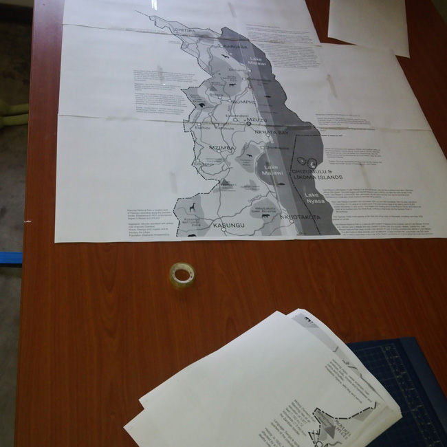
After a few days of work, I printed the map out and had to stick it all together.

The text was too large! Things were getting in each others way.
So I got back to work and it dragged over a few months. I had to make way for projects that will actually put food on the table.

I still need to put four dozen more places of interest. Some features are still getting in other features ways. A hundred reasons not to publish this but thought I would do it anyway. Perhaps get a few suggestions of some interesting places or pieces of history that I would never have thought about.

Almost a third of Malawi is covered by the lake.

Chongoni Rock Art is a UNESCO World Heritage Site

Likoma and Chizumulu Islands sit in Mozambican waters but are very much Malawian.

Nsanje is like the hottest part of Malawi
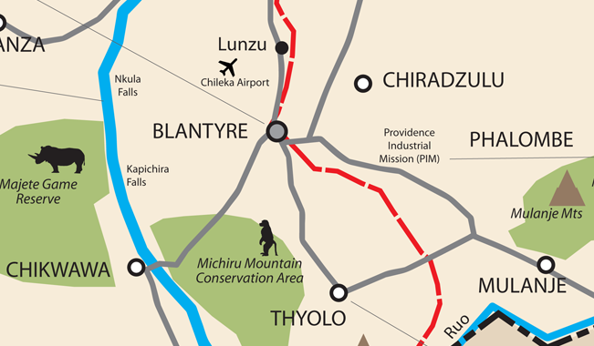
Blantyre is one of the oldest urban centre in east, central and southern Africa and it pre-dates Nairobi, Harare and Johannesburg.

The map is not drawn to scale.
Fast-forward after I first started this project - Version 1 has now been printed! That took a minute... :)


