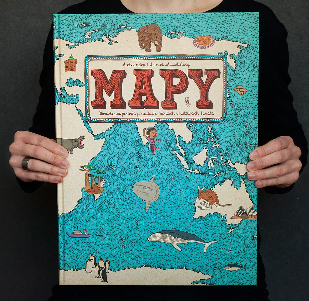
MAPS
a journey around the world in pictures
a journey around the world in pictures
Atlas composed of 51 maps full of details and curiosities, presenting 6 continents and 42 selected countries. The maps show not only borders, cities, rivers and peaks but also the places of historical and cultural interests, eminent personalities, most characteristic animals and plants, ways of spending free time and many more fascinating features.
It took us 3 years to create “Maps”. Aside of creating over 4000 illustrations we designed two type faces just for this book (Mrs White and Cartographer).
It took us 3 years to create “Maps”. Aside of creating over 4000 illustrations we designed two type faces just for this book (Mrs White and Cartographer).
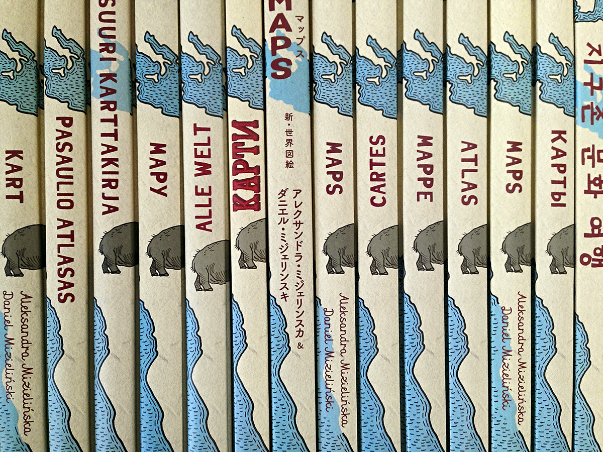
Polish edition: Wydawnictwo Dwie Siostry
British edition: Big Picture Press (buy on amazon uk)
US edition: Candlewick Press (buy on amazon)
German edition: Moritz Werlag
French edition: Rue Du Monde
Russian edition: Samokat
Netherland edition: Lannoo
US edition: Candlewick Press (buy on amazon)
German edition: Moritz Werlag
French edition: Rue Du Monde
Russian edition: Samokat
Netherland edition: Lannoo
Italian edition: ElectaKids
Korean edition: Green Book Publishing Co.
Japanese edition: Tokuma Shoten Publishing
Chinese Simplified edition: Beijing Yuanliu Classic Culture Co.
Chinese Complex edition: Global Kids Books
Danish edition: Carlsen
Finish edition: Nemo
Georgian edition: Diogene
Icelandic edition: Forlagið
Lithuanian edition: Terra Publica
Norwegian edition: Fontini
Swedish edition: Alfabeta
Thai edition: Nanmeebooks Co.
Ukraine edition: Stary Lev
27,2 x 37 cm, 108 pages, hardcover
You can see bigger images on our website.

Poland

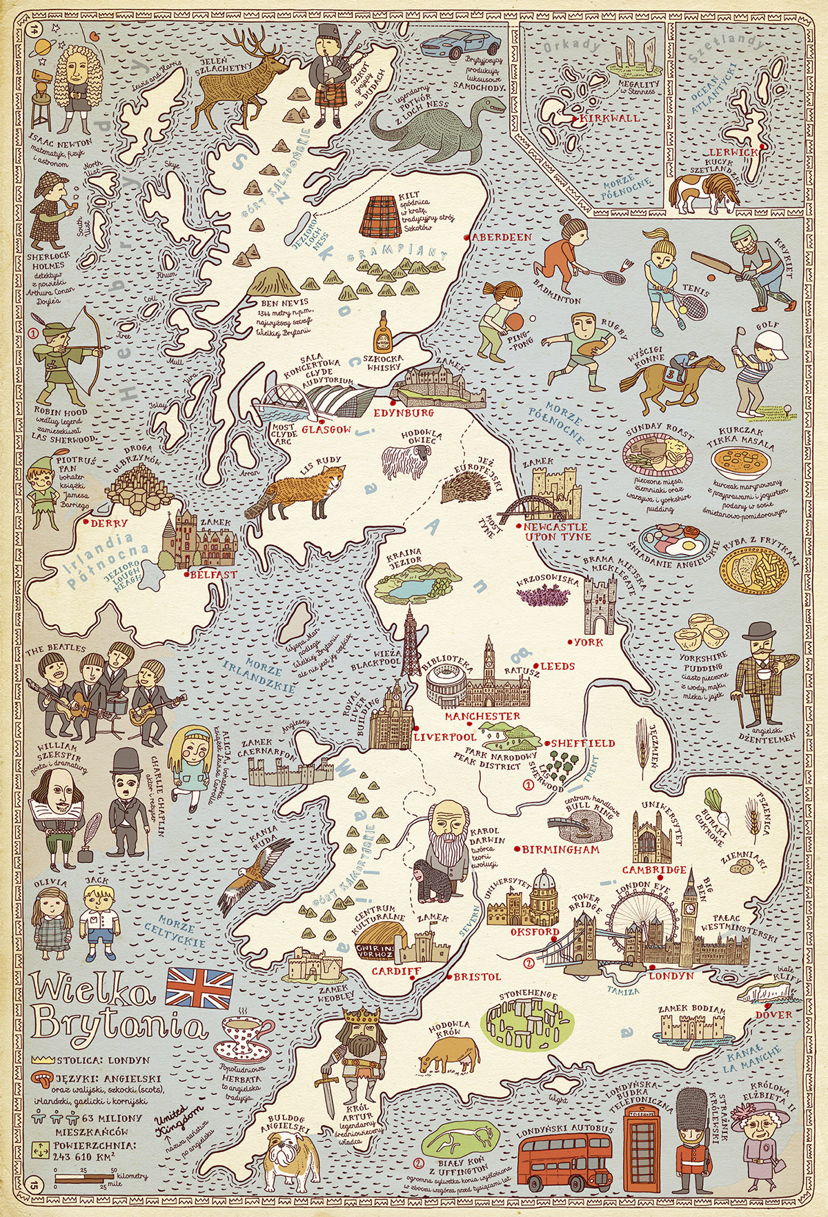
United Kingdom
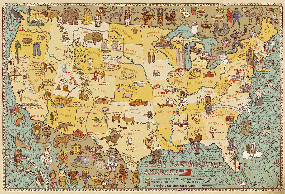
United States of America
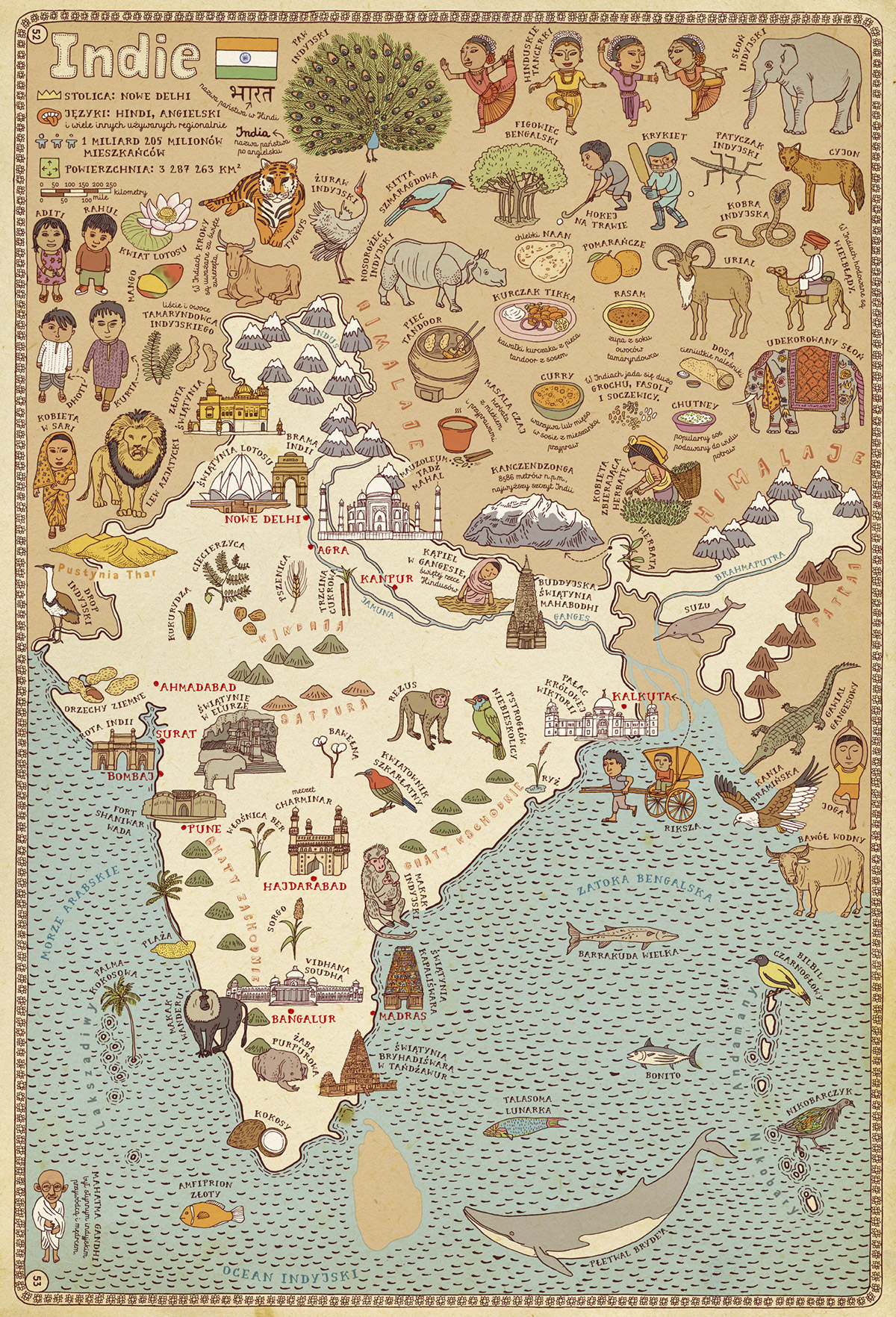
India
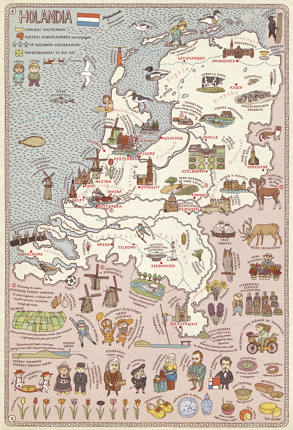
Netherlands

United Kingdom (close-up)

Netherlands (close-up)
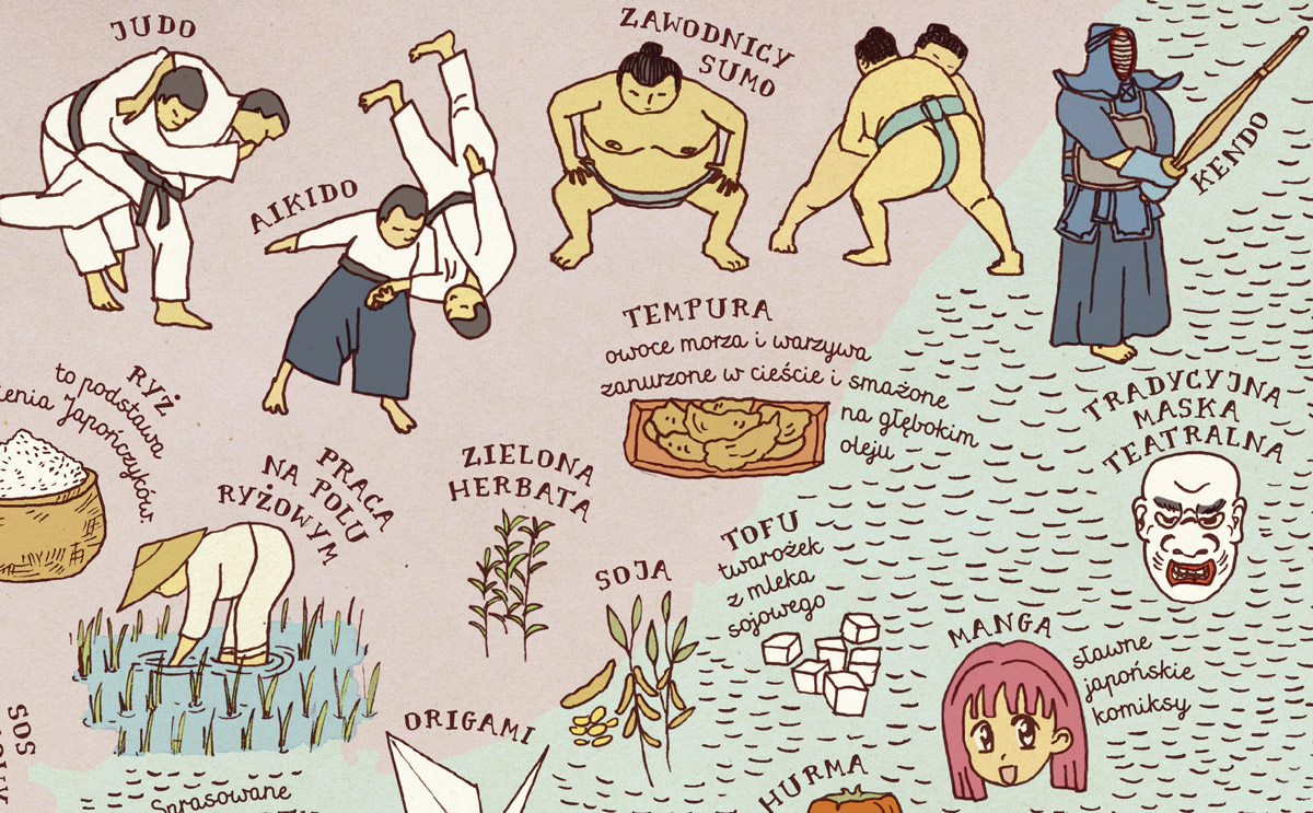
Japan (close-up)

Japan (close-up)
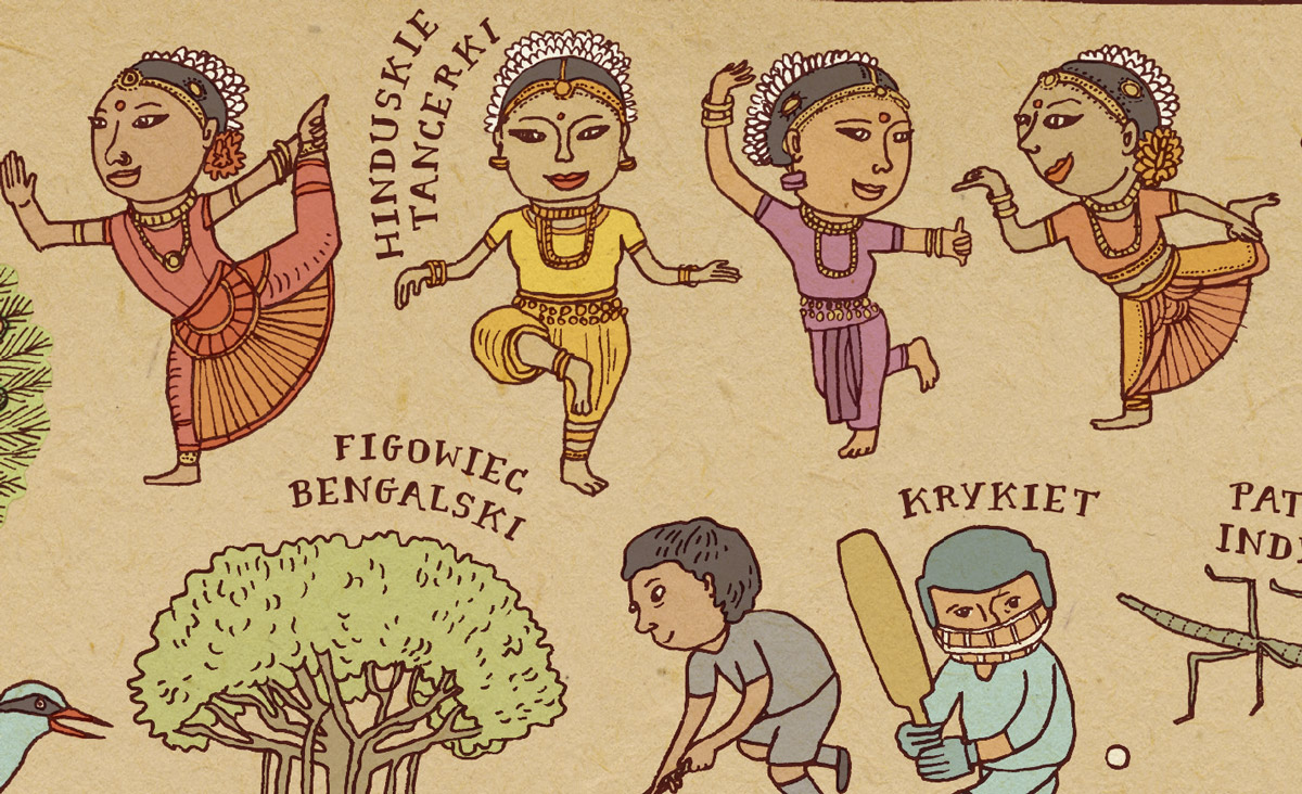
India (close-up)

Ghana, english version (close-up)
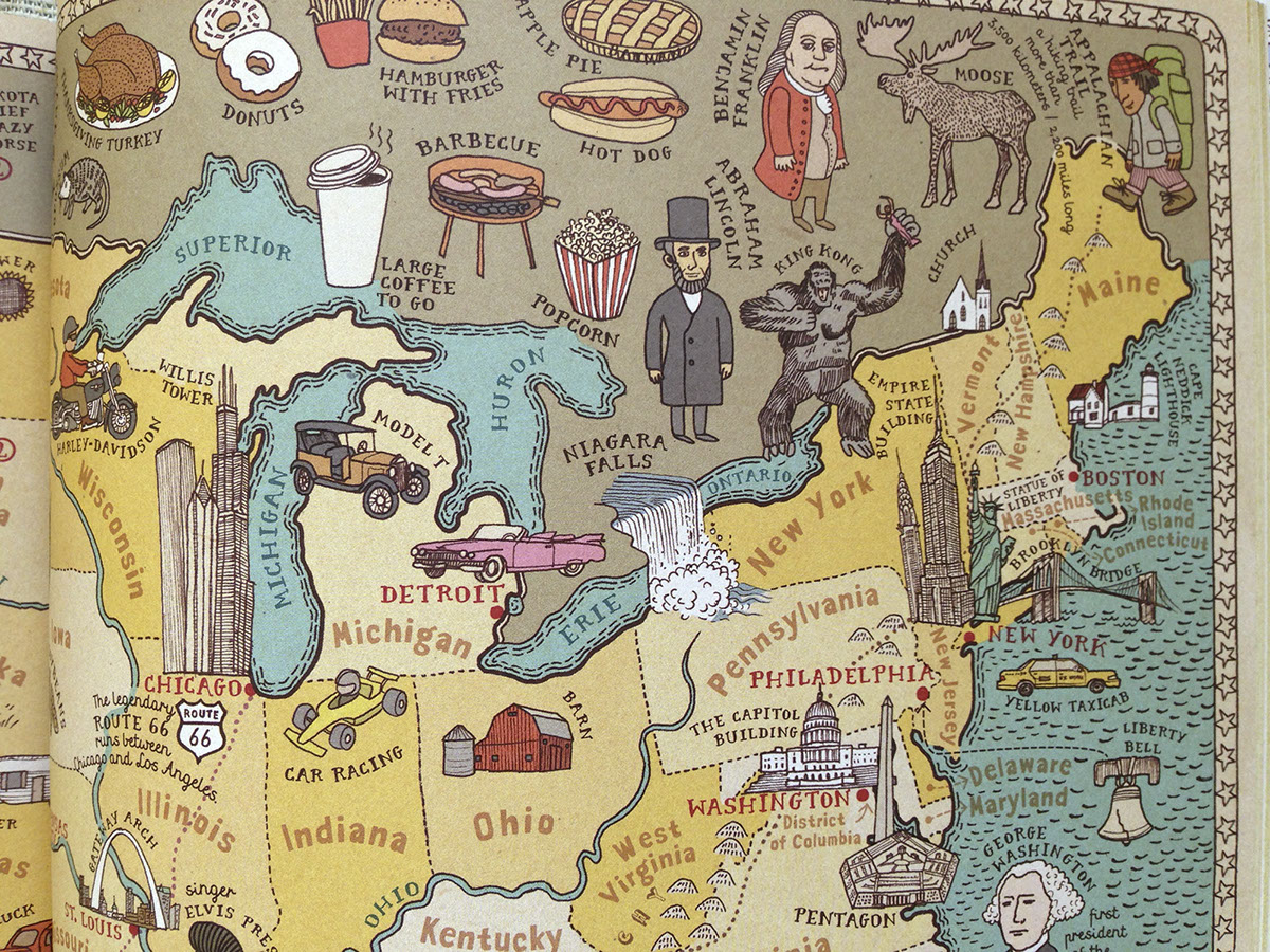
USA, english version
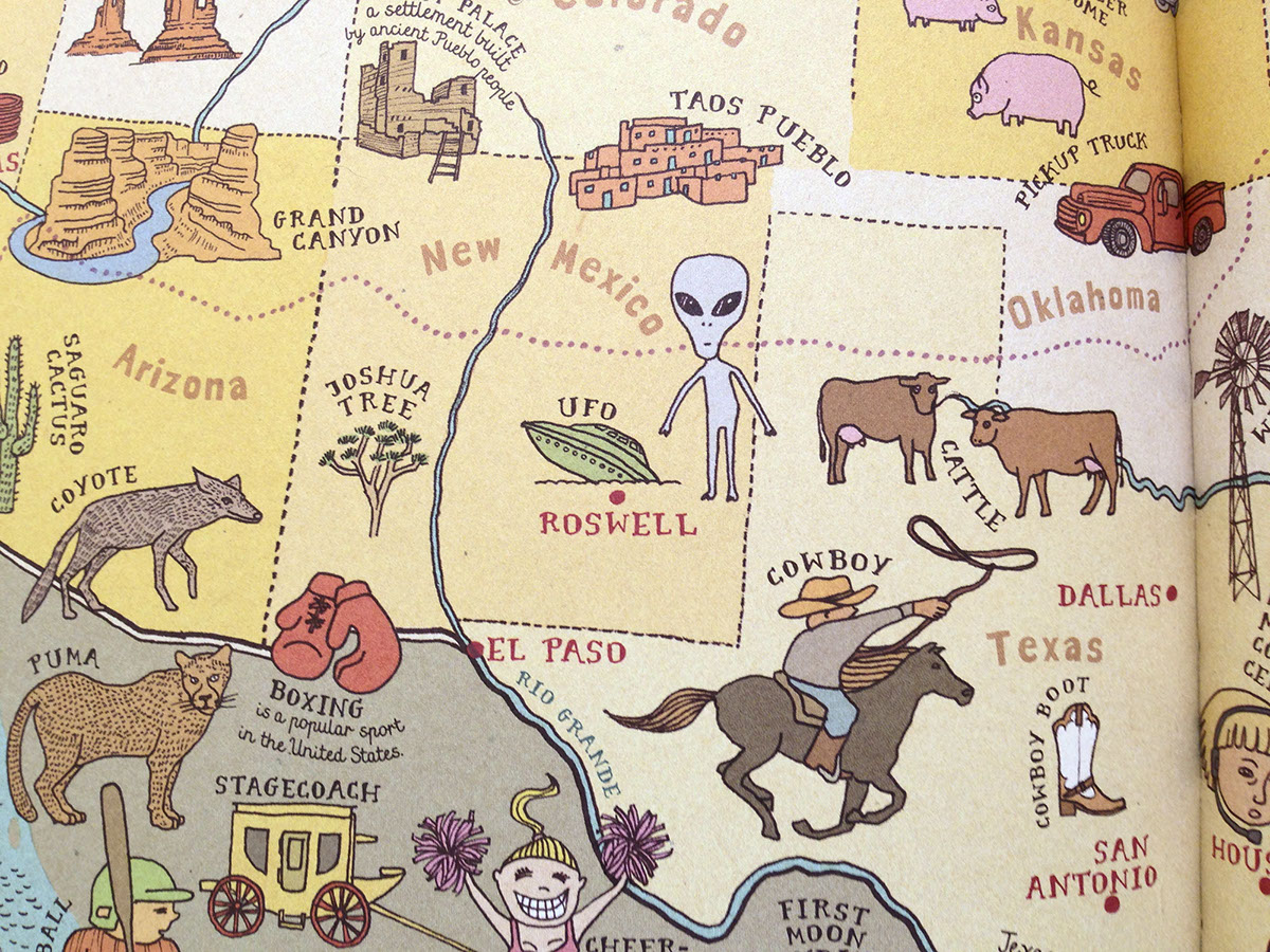
USA, english version

United States of America, english version, (close-up)

Russia, french version (close-up)

Fiji, french version (close-up)
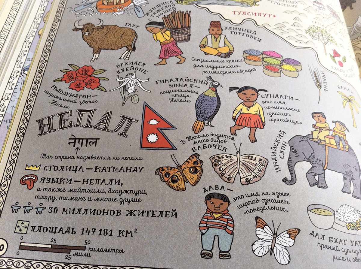
Nepal, russian version
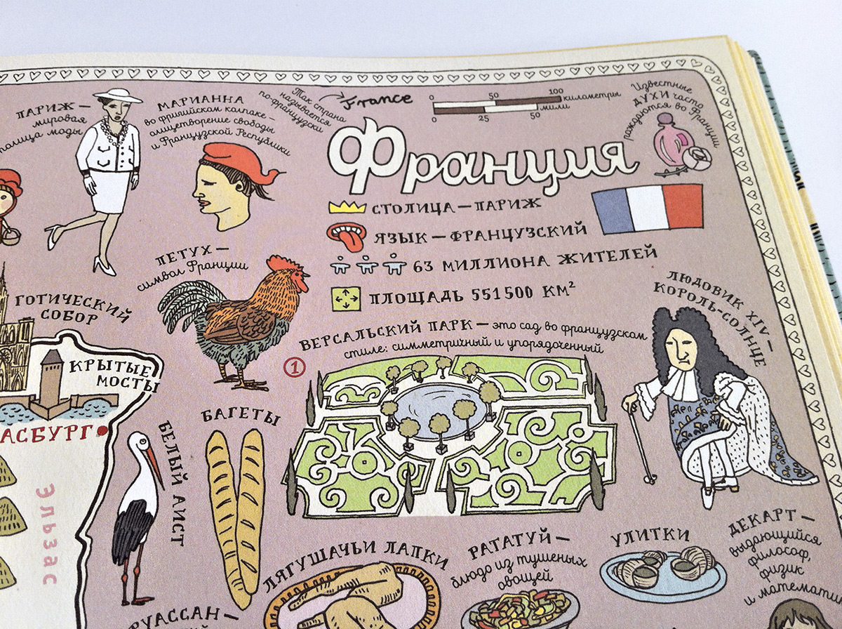
France, russian version

Italy, russian version

Jordan, russian version
You can see more on our website.

